Showing posts with label sydney airport. Show all posts

Tuesday, December 16, 2014

Not the past - the future, That "new" airport site at Badgery's Creek - Sydney's "2nd" airport

Badgery's Creek. Western Sydney Airport. Or whatever it will be called. Well it's not "new" at all, it's not the first nor the only airport (or perhaps "airstrip") in the immediate area. But if built it will be the biggest. And it is another regular public transport (RPT) airport for Sydney with full allowance for both international and domestic services as well as future capacity increases. 

Badgery's (let's call it WSA) in a nutshell:
  • It's big, bigger than Sydney (let's call it KSA for "Kingsford-Smith Airport")
  • It won't start as big as you probably imagine
  • It won't open until at least 2025
  • It isn't guaranteed to succeed, or grow, but probably will
  • Runway alignment, operational "mode" and noise footprints aren't a done deal and...
  • The last EIS we have (courtesy Blacktown City Council) is huge, impressive, and out of date.
Basically, all we can do is read what we have, interpret it as it stands and update it in our own heads - at least until we get told some more. This post is a stab in the dark based on what I have found. It's long, too. If it helps someone piece this together, great.

A "Western Sydney Airport"? It's not a new idea, being one of several seemingly endless options explored since the end of WWII. It is the one that has been chosen, though. Not that being chosen means much. Badgery's Creek was first "chosen" in 1986. Given the politics played out already, it conceivably may still not go ahead at all. It's not planned to be open for business until 2025, after all.
Badgery's Creek - or Western Sydney Airport (WSA) - is on the lower-centre-left of this Google Map image, Sydney (KSA) on the lower-right. Depending on how you measure it, you are looking at 40 to 50kms between them. Fancy paying for a taxi cab?

Do we need it? The existing Sydney Airport can arguably handle more passengers and aircraft movements, by some accounts to 2025, by others (notably SACL, the airport owners) to 2045. Indeed aircraft movements are constrained more by legislation than by actual capacity. Whilst the legislation is there to protect residents from excessive noise, cold-hearted rationalists could observe that the cost of these restrictions to our community overall is too great. By allowing more flights in a greater spread of the day and night, or by shifting regional and/or freight traffic to existing alternatives such as Bankstown, Richmond and Camden, the "need" for a 2nd major RPT airport in Sydney is removed or at worst pushed further into the future.   

Could the money - some $2.4 billion for the airport infrastructure and perhaps $4 billion more for land transport - be better spent elsewhere? Investment of any sort has a varying multiplier effect on the economy and finding the investment sweet spot - the best return - matters. You don't just throw cash away and hope for the best, after all. Mind you, the stakes are high. It is a big investment that impacts the region - and the nation - socially and politically. It will create local jobs - airports do that - and maybe pull some jobs away from the existing Sydney Airport. It opens up regional development more broadly, increases land value and creates opportunity. Of course such opportunities divert us from other possibilites, too. Perhaps better ones. And when land use changes the door opens to the speculators and developers. All well and good, as long as it's transparent and fair, especially to the current owners and residents.  

Will it get built, and will it get used? Will the airlines use it? Only if they have to, I suspect. Do existing airline operators really want an alternative Sydney operation, another terminal, more staff on the ground and the extra complication of airport transfers? If you thought it was a hassle getting from the "domestic" side of KSA to the "international", imagine what it will be like if your connecting flight is at another airport some 40 or 50 kilometres away. Hail that taxi!

Existing airline operators may well hesitate; but some - perhaps those without an existing foothold at  KSA - may actually want to claim Western Sydney as their own. Perhaps entirely new airlines will want "in". But which ones? Freight? Regional? Low-cost domestic inter-city? International?

Will the existing Sydney airport operators, SACL accept the competition without fuss, or indeed take up their first refusal rights? As far as I know they are still in "discussion". I'm sure they'd like to lock up the whole Sydney market, if only to protect their key asset - KSA.

What about the politics? Frankly, I don't think the political will is strong enough - or the election cycle long enough - to get this one off the ground as intended. With every change of government the policy shifts. In brief we have swayed from "let's do it" to "hang on, let's invest further at KSA" to "let's start small with a GA airport" and back to "no, let's do it"... peppered with the odd "how about we choose a new site?". 

Yes, something will get built - if real spade work actually starts in 2016. It may only be a hole in the ground, though, if even that hole gets approved. Badgery's looks and sounds too good, especially when the media spin amps up the positives for the economy of Sydney's west, to just vanish completely. It's dangling there with a lot of other investment: new roads (big orbital ones, too); new rail (well maybe, if all comes to pass); new jobs (certainly in the construction phase and probably later as well). And so on. A lot of people want a slice of this "action".

But who knows exactly when or even if? What about upcoming State and Federal elections? Will the commitment remain, irrespective of result? What if the roads are built but no airport? What if the airport is scaled back in scope? What if it is built but just isn't used? What if it's just a sly way to shift some noise and aviation fuel from the east out west?

Still, let's not be negative. On paper it looks attractive. If it helps build value and jobs in western Sydney, good. If it takes some noise burden away from the current KSA footprint, great. So let's assume that somehow, something good will eventuate.

So what's next? OK, we have a site decision. Sure. We had that exact same decision perhaps 28-odd years ago (Hawke/Keating), except for the subsequent reversal (Howard/Costello), procrastination (everyone) and political second-guessing ever since. But now PM Abbott says "yes". Whilst a split Labor Party says "no", probably, most likely. 

Assuming PM Abbott doesn't pull the pin, from here we have further planning and design work to be done. Negotiations with all affected parties. Plus renewed noise and other environmental impact assessments to be done. There's an endangered environment on the site and threatened species to be protected, too. Both the known and the as-yet unknown problems will need to be resolved in order to get traction. Perhaps more land will be required as well. It all takes time. Delays abound. Keep 2025 in mind. It may slip. Probably will.
Location map from the Draft 1997 EIS.

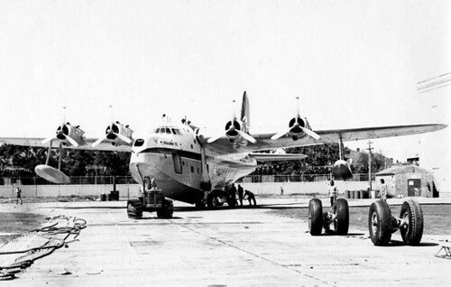
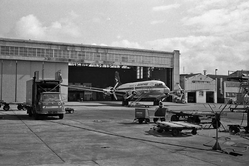
What does experience tell us? As a personal learning note here, let me say that I grew up under the 16 approach at Sydney (Kingsford-Smith) Airport. It wasn't the main runway for most of my early years but it was extended and extended and even duplicated until it became the focus for most of Sydney Airport's air traffic. Interestingly whilst the noise levels and frequency of movements increased substantially over many years, they also fell at times. It wasn't a given that things just got worse.

I won't say that it wasn't unsufferably noisy at times, it was, but I have to admit that 3 things in particular happened: firstly, aircraft engines became measurably quieter; secondly, those engines grew more powerful; and thirdly, on average, aircraft grew much, much larger.

Another thought here is that the flight paths changed over time. Especially so for inbound traffic. Different aircraft with different performance characteristics, coupled with evolving air trafic control procedures and technology meant changes to the areas affected by aircraft noise.  

Having said that, what I would suggest now is that aircraft will probably not grow much larger than they are currently. I could be wrong of course but a triple decker seems unlikely. Still, it's possible. There may even be demand for such an unwieldy beast. It's also conceivable that airliners could grow further in length; but you get into all sorts of engineering limits as such elongated designs must rotate to lift off, without tail strike. And loading weights per tyre and wheel combination are a factor, too, both in engineering the aircraft and the concrete it lands or stands upon. New configurations, even twin-fuselage designs, can't be ruled out, of course. But whilst we must consider all of this in our airport design, it remains highly speculative. The problem is, should we guess wrongly with placement and design it's expensive to fix.

Whatever else happens with aircraft engineering, I would expect the noise to continue to fall, if only slightly, and for aircraft engine performance to continue to improve. In this way the noise footprint will continue to shrink, particularly for departures (which require full throttle and "max noise", generally). And with better design and a bigger performance envelope comes the possibility of "sharing" the impact more widely. In theory.

However the other lesson here is that successful airports attract people. If successful, it will get hemmed in by developments. But we all know this. So land will be reserved for "noise mitigation" reasons. And land will be reserved for runway duplication, too. Duplication that will inevitably widen the noise footprint. Just watch as history repeats itself.

At this stage, though, all we can do is "trust" that the currently empowered authorities will do as they say. So what are the plans, as we know them? (Knowing also that they will be changed: what we don't know is by how much.)

Runway alignment. A big question mark here. Given the orientation of the land already purchased, plus the prevailing winds and topography, a north-east by south-west alignment is probably what's on offer. Whilst an additional crosswind runway would aid smaller aircraft operations, particularly in the strong westerly to nor-westerly winds likely from August through to the end of summer, there's no hint as yet of extra land resumption. A shorter crosswnd runway would fit, just. Nevertheless unless it downscales to a GA airport (to ease Bankstown's load, for example) I think a crosswind runway is unlikely, at least at the possible 2025 opening date.
Generic master plan, from the Draft EIS again. Take it with a grain of salt, of course. Tilt it towards the north-east and it's your guess which parallel runway gets built first. Toss a coin with the shorter crosswind strip, too. If more length is added to the cross-strip (or a parallel one built) or more noise abatement required then more land will need to be acquired.  

Noise Footprint. Yes, people do live in the area, but far fewer than live around Sydney's current major airport. And the denser population centres are much more distant from the proposed runways than the existing high density population that surrounds all but the Botany Bay-facing runways. WSA is surrounded by paddocks, mostly. Yes, Sydney does have the benefit of Botany Bay, true. But not all traffic can come and go over the water.

That's the good news: "It's not as bad as KSA". Catchy slogan, yes?

Once runway alignment is agreed, which looks decidely NE-SW at this stage, integration with existing flightpaths and other airspace restrictions will have a bearing on which areas are directly under the footprint.

Bear in mind (a) most likely just one runway will be built in the first phase; (b) upon reaching a safe altitude aircraft will most likely turn either left or right after takeoff, depending upon destination and designated standard departure procedures; and (c) approaches will similarly include standard corridors to the left or right of the field as well as to the north and south, allowing safe traffic separation. Altitude and throttle settings are important factors in noise mitigation of course and it is likely that specific noise-limiting procedures would be implemented over residential or other sensitive areas.
The indicative Cox Richardson graphic above shows the standard ANEF noise footprint of the assumed runway alignment overlaid on land use. Most of the affected area has already been rezoned industrial or contains low-density residential, however the underlying assumption is for sound-proofing of affected residences as well. The areas of highest impact are relatively distant from the twin parallel runways shown, certainly so in comparison with existing impact at KSA. Nevertheless when the final alignment and flightpaths are agreed and real-world noise measurement testing is undertaken it's likely that noise-related resumptions would be considered.

So, again, get out your grain of salt and ponder the following... 
Above, that's the indicative flight path for option A, airport operation mode 1 from the '97 EIS. Don't get scared. Nothing's decided and the assumptions are both many and largely out of date. Read the full EIS or just take my word for it: it will change. Nevertheless it gives you an idea what approaches from the south west and departures to the north east may look like. But the final runway alignment? Who knows.
Again, to be taken with a grain of salt: from the '97 EIS showing approaches from the north east and departures to the south west.

Note that the airspace over Warragamba will be overflown only at considerable altitude, as will other water catchment areas towards the Illawarra. The '97 EIS certainly assumes that Warragamba airpsace will be used; and I do agree that it makes sense from a noise abatement perspective; however it may raise public debate over water quality and world heritage issues. It shouldn't be an issue as jet aircraft exhaust is "relatively" hot and clean, especially in comparison with internal combustion engines, and modern aircraft climb quickly. Yes, jet fuel - essentially kerosene - differs chemically from unleaded petrol, but studies have shown that aircraft exhaust "mixes" readily and disperses quickly over a wide area, whereas land-borne transportation typically disperses more slowly and creates more readily identifiable particulate deposit zones. Or to put it more clearly, you'd be far worse off beside a main road.    

It's unavoidable that areas to the immediate north-east and south-west of the runway(s) will be "in" the affected zones, unless of course in the passage of time the runways are turned 180 degrees. OK, that seems unlikely, but let's not forget that runway alignment is not locked in. The '97 EIS dealt with 3 primary options plus different airport operational modes, and it's worth remembering that anything could change. Nevertheless here is another pretty illustration for you...
Harking back to that Cox-Richardson landuse overlay, this image (above) is the suggested N70 noise contour for Option A, mode 1, from the '97 EIS (N70 being a different methodology from the ANEF standard). The underlying assumptions include runway heading (not locked in), 30 million passengers a year (not really likely, at least from day 1) and a fully loaded 747-300 (not going to happen so much in 2025, it'll hopefully be a mix of newer aircraft).

You need to read and interpret the full EIS in context but if I dared summarise this, if you were living inside the red line you'd have a real problem; if you lived within the orange loop you'd still be upset about it; and the further out you go the less of a nuisance the noise may be. You may still be interrupted in conversation, and you may get disturbed at night. It will be an individual response. It will still matter to you, depending upon the situation. Schools and hospitals are individual cases where it may matter more. It all depends.
And here (above, same source) is option C, similar assumptions (but with the crosswind runway, used sparingly). Look what happens when you rotate the runways towards north. All of what I have written already applies here - don't panic, don't assume the worst. If a runway points directly at you then yes, it's likely that you'll get some aircraft noise. But departing aircraft gain altitude, may throttle back and generally turn towards their destination; which all means that the noise diminishes from point of take off. And arriving aircraft are of course throttled back, join the approach at different points, and are at a greater altitude when at a greater distance from touch down.

They do, however, make a lot of noise and vibration when using reverse thrust, but even this is mitigated by long runways and taxiways designed for faster exits. All of that aside, it's not precise, and it's full of out of date assumptions; but it does give you a rough idea, though.

World Heritage areas will likely also be "out", as will the rising land to the west, except, again, at altitude, and in a designated corridor.

Military airspace too will be "out"; so dodging around Richmond and Holsworthy will be a given, although again the airspace restrictions are governed by altitude (ie there is an upper cap to the restricted military airspace, allowing overflights).  

But - like I've said - we don't know for sure about any of this - yet.

Bear in mind too that whilst aviation noise is unique in character it is not alone in affecting quality of life. Road and rail noise impact is real as well. And I haven't even touched on that. And I haven't mentioned air pollution either (it'll probably improve to the east of the field and worsen to the west); or even "odour". Yes, people complain about KSA's smell, although how they can tell it's an airport smell from 10km or more away is beyond me. Personally I can recognise that 'aviation kerosene' smell only up to about 5km away... anyway, it's all in the '97 EIS.

It gets complicated. It's not just noise mitigation that needs to be catered for. Of course you need to separate air traffic safely, too; so the airspace around Sydney, Bankstown and Camden airports will need to be accommodated; as will Albion Park, Wedderburn, Wilton, Warnervale and The Oaks airfields, too. Mixed air traffic would approach and depart these airports via defined corridors, in some cases by special exemption from otherwise strictly controlled airspace, or by curtailed control zones for individual airports. This is done now to separate Bankstown's general aviation traffic from Sydney's control whilst allowing such mixed traffic to flow freely. Of course "layers" of traffic will be separated by altitude, too, as they are now.

It can be done, it's not rocket science - especially when you realise that the aviation world operates in an environment based on airspace stacks, separated not just horizontally but vertically as well.

And in the end all things are possible if enough money is thrown at the problem. If the preferred solution is closure of one or more airports (or conflicting runways) then - presumably - compensation would be required.     

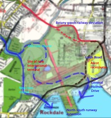
Transport integration. A big one. Improved roads and (perhaps) heavy rail are planned but it's roads first (for now). Whilst roads are important, it's worth noting that over-encouragement of private motor vehicle use increases demand for car parking, including "drop off" zones, and may lead to road congestion and capacity "pinch points". Sydney Airport's Domestic terminals are, for example, constrained by the capacity of the loop road that feeds the terminals. Whilst suitable shuttle buses on appropriate routes will ease those problems, light or heavy rail options appear preferable to many. Shuttle buses, after all, are also "traffic".  

If the Very Fast Train (VFT - or High Speed Rail) is a goer (and not a white elephant in disguise) then will it run via Sydney Airport or via Badgery's Creek? Neither? Or both? What about compensation for the "losers" in each scenario? Indeed the VFT represents competition for commercial aviation and may seek to navigate between the airports, even if the public good appears to favour connectivity rather than separation. There are huge arguments yet to come.

At least there's the semblance of a NSW Government plan with heavy rail extensions and reservations to service Badgery's. All drawn on a nice chart.
Of course this is all very orbital and north-south, although clearly both the SW and NW rail links eventually head into Sydney or Parramatta or both; and the SW link will get you to the current Sydney Airport if all of the planned connections are put in place. But until that's all done it's the road network that will ferry passengers between the airports, if that's what they want to do. (And if your connection is at the other airport, that's what you'll need to do.)

But with a "roads first" policy in action currently the likelihood is for multiple shuttle bus routes from Badgery's Creek to nearby heavy rail stations, to Parramatta CBD and on to Sydney Airport itself. For now, anyway. Or catch a taxi, of course.

Further land acquisition? The Ernst and Young Economic and Social Impact report (2012) suggested that "the latest footprint of the site will still require additional property (30 lots) to be compulsorily acquired at the southern end of the site. In line with Australian health and safety standards for noise pollution, properties located within Australian Noise Exposure Concept (ANEC) contours 40, 35 and 30 should be acquired by the Commonwealth Government. The analysis undertaken by WorleyParsons found that there could be up to a further 62 allotments that should be considered for compulsory acquisition as a result of noise impacts from the airport".

I doubt that a crosswind runway would eventuate, however if it did it would be constrained within the current site to well under 3000m. If proceeded with, further land acquisitions to the east and/or west may have to be considered. It would be for regional or smaller aircraft, generally, or larger aircraft landings. 

Other risk factors. Much (if not all) of the reasoning behind a Western Sydney Airport is predicated on continuing - and expanding - demand for air travel. Underpinning that demand is the rate of world and local economic growth, which is currently subdued by many factors. One big factor is predicted global climate change. If current climate trends continue (as seems likely) then an increasing amount of world economic activity will focus on renewable energy provision and alternative, low-energy transport systems. How aviation - as a high-energy activity, especially on take-off - fits into that scenario is moot. It is likely that commercial aviation will face stiffer competition from alternatives such as high speed rail (HSR) over time. Whilst there are currently no HSR projects underway in Australia there is a groundswell of opinion in favour of it. Such projects would have obvious impact on both major regular public transport (RPT) airports, Sydney and Western Sydney. It is also worth noting that Sydney Airport faces the allied and perhaps more pressing impact of rising sea levels, which ultimately could strongly favour Western Sydney Airport's cost competitiveness.

If world action on climate change continues to grow then the possibility exists for commercial aviation to be  identified more negatively and government action taken to dampen demand. This could be by direct-cost imposition of levies or taxes. The least impactful (whilst still effective) method would be via an emissions trading scheme (ETS). Many countries are indeed taking the latter approach. Ironically, of course, Australia has reversed its tactics in this regard, repealing the carbon tax, the  precursor to an intended ETS.        

So what is likely to change? Everything. The expense is huge and variable, both in dollar terms and the human and environmental cost. The pay-off is big but less certain; but to not act - after decades of indecision - risks hitting some sort of capacity limit with current aviation infrastructure. It's a gamble either way. More to come, I'm sure!

Oh, and someone seems to have their own airport design already in place on the Badgery's site (via Google).

At the end of the day you may weigh it all up - the noise, the traffic, the polution - and think it's a good idea overall. It saves driving to KSA when you need to get to the airport. And you may even get a better paid job out of it. Or maybe you'd just prefer a High Speed Train instead. It's your vote, and I suspect the whole issue will crop up at elections, State and Federal, more than a few times before we reach 2025.  

More reading (some key sources):
Blacktown City Council - Draft EIS from 1997
Aboriginal heritage study - Draft EIS
Infrastructure and Transport - Joint Study on Aviation Capacity Sydney Region 2012
Infrastructure and Transport - Ernst and Young report on Economic and Social impact of airports 2012
Transport for NSW - consultation, SW Rail link extension
Bob Meyer, Cox Richardson presentation (including transport, land use and ANEF charts)
Sydney Airport's long term operating plan, including noise mitigation
Infrastructure and Regional development - High Speed Rail Studies
International Transport Forum on expanding airport capacity
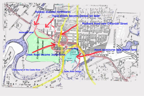
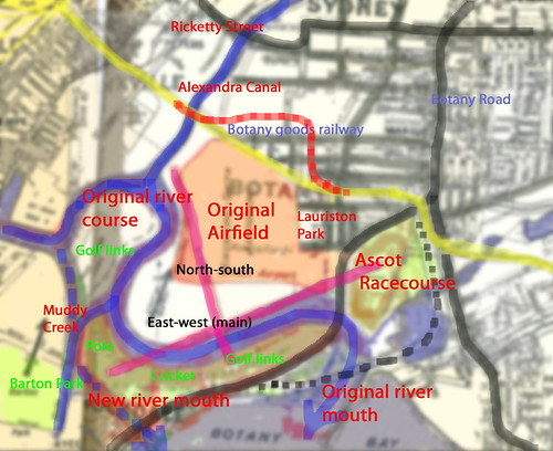
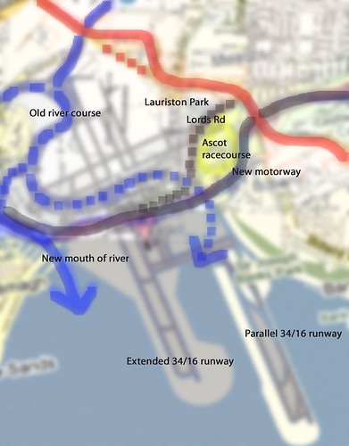
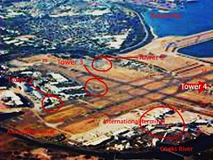
An interesting timeline on Sydney's airport planning.
NSW Business Chamber - economic impact of a Western Sydney Airport
James Badgery - was into the ponies.

And for your amusement and edification, how about this impressively obsessive Condell Park site seemingly dedicated to defending the Bankstown community against any expansion of their local General Aviation airport. The detail is amazing (although sometimes colourful, incomplete, out of date and always biased) and they have done a lot of research, especially on runway length. Bankstown, of course, was once paddocks and no-one really complained about its wartime use by a variety of forces (who would dare, of course). But post-war many people (including an aunt and uncle of mine) moved in and hemmed the airport in from several sides - but especially from the eastern, runway-facing Condell Park side - and to the north. It's no one person's fault but it's a classic tale of airports attracting jobs, people and their houses. 

Or check out my ever-growing list of Sydney's past and present airfields and airports
    

Friday, November 28, 2014

Sydney Airport - Kingsford-Smith, Mascot and Ascot racecourse

Well we call it Sydney Airport but really it's just one of many in the Sydney region. It's not the largest either but it is the "international" one, of course. And the one we first think of, unless you think of Bankstown or Richmond or Camden or whatever first.

It isn't - or wasn't - the Sydney international airport at Rose Bay, of course!


That one was at Rose Bay on Sydney Harbour. 

No, we are looking a a land-based "airfield". Like Rose Bay it's historically important - not because it was Sydney's first aviation location or even "landing ground" but because it's relatively old and significant on several different levels. It has layers of history, with indigenous use, environmental importance, recreational use and major engineering works to commend it to our attention. We've even moved a river just to accommodate it.


In short, Sydney "Kingsford-Smith" Airport at Mascot is one of the oldest continually operating airports in the world. In 1919, Nigel Love's Australian Aircraft and Engineering Company leased land from the Kensington Racing Club (adjacent to Ascot racecourse) and established an aerodrome. It was, basically, a swampy paddock. A flat, swampy paddock. With Cooks River to the west, some recreational grounds and Botany Bay to the south and Eastlakes swamp to the east.


As an aside, it was H. E. Broadsmith and Nigel Love who in 1919 established Australia's aircraft manufacturing industry, forming the Australian Aircraft and Engineering Company (AAEC) to  produce 6 AVRO 504K training biplanes for the R.A.A.F. and 7 for other customers. Broadsmith determined that Mountain Ash was the best local timber for manufacture to British Aeronautical specifications.

A canvas hangar was built and the first aircraft was assembled on site; the first flight taking place in November 1919 with the aforementioned Nigel Love in command. By the mid-1920s, regular air services between Sydney, Melbourne and Adelaide were underway and the Australian Federal Government had taken control of the airport. In the 1940s a passenger terminal was opened and the Cooks River diverted to allow for the construction of two new runways, including 07/25 as the "main" runway aligned east to west.


Both the suburb of "Lauriston Park" and the Ascot Racecourse, immediately to the east, were subsumed into the growing aerodrome. As shown in the map above, the main road south originally  split the racecourse and the aerodrome, with a tramline and a balloon loop to the north of the racecourse itself. As the airport grew the road south - and its bridge over the Cooks River - was diverted to the east. The Cooks River itself being diverted to the west.    

During WWII Sydney hosted No 4 EFTS at Mascot, part of the Elementary Flying Training Schools (EFTS) scheme, later to be re-dedicated to Communications.
 
In 1963 work commenced on the construction of the 34/16 runway extension southwards into Botany Bay, in preparation for larger, heavier international aircraft carrying greater fuel loads (and needing a longer runway). In 1965 work commenced on the construction of the "new" International Terminal, again in readiness for newer, larger aircraft (not that they actually expected the Boeing 747 to be quite that big.).


In 1989 a fairly close-spaced and slightly staggered parallel runway 34/16 was approved, being  completed in 1994 (making 3 operational runways).

After all of that investment the Australian Government then privatised - for better or for worse - Sydney Airport in 2002.

Not to be confused with Western Sydney Airport, not built but "planned". 

or checkout my list of Sydney and surrounding airstrips and airports

Wednesday, February 20, 2013

Secrets, Sydney's airports and the Central Coast

Yes, I live on the Central Coast, but I grew up in inner western Sydney right under the flightpath to what became the main, longest runway. I loved it. My mother hated it. Of course she had earlier moved from Kogarah (which was under what was then the main runway's flightpath) to Marrickville when it was affected only by the "second", less used runway. And before the jet era, anyway. But they grew that short, secondary runway into the bay, an eminently sensible option in many respects, didn't they?

Of course the noise could be horrendous - and isn't much better now, even if high-bypass engines are demonstrably quieter and cleaner. And back then planes were smaller, so there were more of them at peak times. But now they are larger but quieter, which somehow sounds good on paper but in reality is as bad as ever. But they bought out the worst affected homes and insulated others, too. So "bearable" may suffice, if you like.

Anyway, point is that it's been there - Sydney Airport - since a certain Mr Love turned some distant Sydney swamp into an airfield not long into the 20th century. The runways were grassed and switched around a bit over the years, but it wasn't a problem for the locals, really, as it was just a swampy area fit only for pony racing, golf courses and industry (at least to a developer's eyes). When international air travel began to take off it was from Rose Bay, not Mascot. Flying boats were the long-haul heavy-lifters of their day. What happened next however is that Love's Mascot airfield slowly grew and so did the surrounding suburbs. And when the flying boats boomed then declined after the second world war Sydney's major air traffic needed to shift to the land - and thus the chickens came home to roost.

Traffic of course grew and runways became fixed - and longer. Aircraft now flew in and out over those growing suburbs to the west and the golf courses to the east. Until suddenly 747s arrived with larger payloads and longer runway requirements. Hence the focus shifted to the short north-south runway which was lengthened substantially into the bay. And then a parallel runway to that was built as well. But well before all of that came to pass various plans were put forward for a "second" Sydney Airport. Indeed there were studies galore.

In the 1970's it was proposed that the Central Coast could well be the right site for a second airport (although in truth there have always been many more airfields in Sydney than just one, indeed Bankstown Aiport has regularly exceeded Sydney in air movement volumes) and a lumpy, foggy and expensive Somersby site was seriously considered, amongst others. But political will was weak and impetus was lost until finally the Badgery's Creek site was selected in western Sydney. Or so we thought. In fact it stalled. And we are left here, decades later, with just the one "main" domestic and international airport at Mascot. Which suits the commercial airport operator just fine, of course, and keeps things simple for airlines and passengers, too. (There's no confusion over which airfield is which, for example, and no expensive transfer to distant termials to change flights.)

Of course Sydney AP could stay "as is" for decades, anyway, or even grow further into the bay.  But the wheels are still turning on a "second" airport - if slowly - and Badgery's - or is it Wilton? - may one day come to be. But that doesn't stop the odd proposal for a regional airport that could siphon off some Sydney air traffic, just like Newcastle airport does today but moreso. It's not a "second Sydney airport" like the beat-up kings at The Telegraph would have us believe but a serious regional airport that would - if allowed to proceed - attract many northern-dwelling Sydney-siders looking for an easier way to fly within Australia. It would be an economic  boon to the Central Coast and make interstate air travel more attractive to many, getting more cars off the roads. But it will get tarred with the usual brush, of course, and is almost certainly doomed.   

Council's airport fibs put region in tailspin | thetelegraph.com.au
Wyong mayor Doug Eaton last month accused the media of a beat-up after The Daily Telegraph reported the council's plans for a second Sydney airport. "The key words here are 'regional airport'," he wrote in his weekly local newspaper column.

"The Sydney media have built it up to be our grab for Sydney's second airport.

"But all we ever proposed was a single runway, type 3 regional airport, similar to Coffs Harbour or Port Macquarie."

Mr Eaton has repeatedly stated it was meant to be a small regional airport despite the proposal featuring a 2600m-long runway, which would make it the second longest runway in NSW behind Sydney's main runway and capable of accommodating international flights.

Yarramalong resident Laurie Eyes, who lodged the GIPA request, said Mr Eaton and the council had been caught out in a "bare-faced lie".

Back-peddling yesterday, Mr Eaton said he strongly refuted claims he or the council misled the public in that the proposal started out as a push for a second airport.
Here is an updated list of Sydney's airports.  

Wednesday, April 27, 2011

Where Qantas hid its DC4 fleet

QF DC4 EDB Sydney 75_245 by gtveloce
QF DC4 EDB Sydney 75_245, a photo by gtveloce on Flickr.
It must have been a tad embarrassing as well as expensive (and arguably romantic, in a way) for Qantas to have to maintain such old aircraft well into the jet age.

Between trips to Norfolk Island's short grass strip the old birds were maintained in the hangars furthest from any passenger terminal but plainly visible to anyone driving from the domestic terminals to the "new" international terminal on the far side of the airfield. It was semi-hidden but by far the most interesting part of Sydney Airport in the 1970s...

Air transport in the 70s: QF DC4, 1977

QF DC4 1977_229 by gtveloce
QF DC4 1977_229, a photo by gtveloce on Flickr.
Perhaps even more surprising than seeing big 4-engined turbo-prop L188 Electras flying into Sydney Airport in the 1970s was seeing (and hearing!) these 4-engined piston and prop-driven Douglas DC4 airliners in regular service from Sydney to Norfolk island!

They would often appear on the distant horizon to the east and north of where I was at Marrickville and lumber their way onto a short final approach to runway 16, making a left turn late over Sydenham. Presumably they were a slow-moving nuisance for the faster jets and were "hurried up" by air traffic control.

Air transport in the 1970s - Ansett L188 Electra

Ansett L188 Electra 76_918 by gtveloce
Ansett L188 Electra 76_918, a photo by gtveloce on Flickr.
Excuse the blur but it was hand-held after dusk!! Point is that it's an L188 Electra, one-time workhorse for TAA and Ansett, forced to serve out its days carrying cargo at night. Sydney then (as now) had a curfew on jets so "quieter" prop-driven aircraft did the night-time shifts. It extended the life of this Ansett Electra, which was retired from passenger duties in the early 1970s.

I remember both TAA and Ansett Electras swooping in from the south, joining the 16 approach quite late, over Marrickville or even Sydenham in order to 'nip in' before a bigger jet. They often soared over my head, one following the other in the 2-airline parallel timetable days.

This particular shot was taken in 1976, close to final retirement from the fleet.

Saturday, July 3, 2010

Historical footnote: prior to WWII pony racing was a big entertainment option in Sydney

Like the lost velodromes of Sydney, there are also the lost pony racecourses such as Ascot, Rosebery, Victoria Park and Kensington. Ascot's track and surrounds were overtaken by Sydney's growing airport at Mascot, Rosebery by housing flats and Kensington by the University of NSW. Victoria Park had several later uses, including the Leyland car factory, Naval Stores and more recently housing.

Pony racing was defined as..."any meeting at which the conditions of any race included any condition relating to the height of any horse, mare or gelding eligible to compete". By 1930 restricted height races were generally programmed for 14.1- or 14.2-hand ponies.

South Sydney's major venues for them in the 20th century were Ascot (now a Sydney airport runway), Victoria Park (a housing development), Rosebery Park (part of Mascot) and Kensington racecourses. Other Sydney circuits for them included Liverpool, Lillie Bridge, Brighton, Belmore and Epping.

In 1907, in opposition to the registered clubs, headed by the Australian Jockey Club, they formed the powerful Associated Racing Clubs (ARC). But it has long gone. Rosebery went in 1962 but the final meeting there took place almost 23 years earlier. Sydney's last pony meeting was at Ascot on August 22, 1942. Rosebery was still operating as a training track in my time and the betting action on official two-year-olds' barrier trials, with the likes of Hollywood George Edser betting (illegally), was greater than at your average Randwick Saturday these days.


By: Wayne Peake Publisher: Walla Walla Press, Newsroom
Between 1888 and 1942, unregistered pony racing broke away from and challenged registered horseracing to become one of Sydney’s most popular sporting industries. It was also big business elsewhere in Australia, and in England, South Africa and India. Peake’s important contribution to Australian sporting and public history focuses on this little known phenomenon. Sydney’s pony racing epicentre stretched from the city to Botany Bay, with the main courses located in Rosebery, Kensington, Ascot and Victoria Park.A fascinating picture of the sport’s prominence in Sydney life over half a century emerges in these pages.

or checkout my list of Sydney and surrounding airstrips and airports

Monday, June 28, 2010

Some snippets of history - lime, mills, dams, silting and sewage : the Cooks River, Sydney

I've previously mentioned that the Riley Street (Surry Hills) indoor board velodrome was shifted holus-bolus to Canterbury - splinters and all - which is remarkable enough, but there's more to Canterbury than just an old velodrome site, a station, a bus terminus and a horse racetrack. There's also a river - the Cooks River - that runs from Botany Bay to Canterbury and further westward. It was of course once a working natural river with meanders but dams, industry and concrete culverts put an end to much of the "natural-ness".

I'll post a map of the Tempe dam soon, but the article quoted below makes the location clear enough. The river was dammed to poor effect at Tempe and at Canterbury. The flood of the late 19th century wiped out much of the market gardening and led to grand schemes of tunnels and canals, of which only Alexandra Canal really came to pass. The river's mouth was also moved to accommodate an enlargement of Sydney's Mascot airport. You can find maps of that elsewhere on this blog.   

City of Canterbury - History of Cooks River
Descriptions of the country along Cooks River by the early explorers were not optimistic about the land's potential for food production. Captain John Hunter and Lieutenant Bradley both mentioned the shallowness of the water and the large swamps, in place of Cook's 'fine meadow', so it was to the alluvial terraces of the Parramatta and Hawkesbury Rivers that the farmers of the colony went. The Reverend Richard Johnson, however, took time out from his chief mission - first pastor to the settlements in New South Wales - to cultivate his properties, among them being a grant of 250 acres at Canterbury (stretching along the river from present Garnet Street, Hurlstone Park to Croydon Avenue, Ashbury). There is no evidence that he ever lived on his 'Canterbury Vale' farm. But with the help of an overseer, several convicts, and labourers paid by himself, he cleared and planted several acres. Yields were high enough from his estates for him to be described by Watkin Tench as 'the best farmer in the colony'. When the property was sold to William Cox in 1800, it included livestock, two acres of vineyard, and another acre of orchard with orange trees, nectarines, peaches and apricots.
City of Canterbury - History of Cooks River
Major industries of the area were fishing and lime burning, especially around the mouth of the river and in Botany Bay. In a new settlement, three basic needs had to be satisfied: the need for food, the need for water, and the need for shelter for the inhabitants. Although brick-making clay was abundant, nothing could be found for a long time to hold these bricks permanently together. Lime, essential in making mortar, was in such a short supply that most brick buildings collapsed in a heap of rubble as soon as the walls were leant on, and Governor Phillip constantly appealed for limestone to be sent out as ballast in the ships from home. Shell middens left by the aborigines on the shores of the Cooks River and Botany Bay proved to be a vital source of lime, and many colonists managed to make a living gathering the remnants from thousands of years of aboriginal meals to supply their kilns.
City of Canterbury - History of Cooks River
Cornelius Prout built a punt to give him access to his property, Belle Ombre (along the river from today's Canterbury Road to Clissold Parade, Campsie); a punt also operated somewhere about the same time at Undercliffe, known as Thorpe's Punt. This was a link on one of the roads to the Illawarra district. Fords existed at Tempe and further up the river, but with the spread of settlement and eventually industry, permanent bridges were needed.
City of Canterbury - History of Cooks River
A B Spark, Leslie Duguid, and F W Unwin all built country houses beside Cooks River in the late 1830's, and by 1840, three bridge crossings were in use; Unwin's Bridge at Tempe, (to give access from Sydney to his house, Wanstead); Prout's Bridge, replacing the punt, at Canterbury; and the dam at Tempe, continuing the line of Cook's River Road (Princes Highway) past the house of Alexander Brodie Spark.
City of Canterbury - History of Cooks River
A second dam was built to serve the river's first manufacturing industry: the Australian Sugar Company's refinery at Canterbury; this location was selected because of the need for ample supplies of water in processing.

The Sugar House is placed within one hundred feet on Cook's River which is shortly expected to be fresh water, the Dam being quite close and is built of beautiful white sandstone. (Sydney Herald, 4 October, 1841)
Cooks River - Wikipedia, the free encyclopedia
The Cooks River is a 23 kilometre long urban waterway of south-western Sydney, New South Wales, Australia emptying into Botany Bay. The course of the river has been altered to accommodate various developments along its shore. It serves as part of a stormwater system for the 100 square kilometres of its watershed, and many of the original streams running into it have been turned into concrete lined channels. The tidal sections support significant areas of mangroves, bird, and fish life, and are used for recreational activities.
Geological Sites - Especially around Sydney
The river was discovered by Captain James Cook in 1770 but it was not until 1793 that any permanent settlement began to occur along it. The first bridge was erected here in 1810, give access to the southern bank of the river for timber getting. It was then a limit of recreational excursions from Sydney.

With the degradation and growing inadequacy of Sydney's Tank Stream water suppy by 1826 the Cooks River was considered as a possibly fresh water supply. A dam was built across it here for that purpose, in the 1830s. The work was mainly completed in 1839-1841 using convict labour. It was considered that floods might flush out the saline water and give allow a fresh supply behind the dam (cf. in a flood of 1889 the river flowed 10 above the dam at Tempe). However, the dam was unsuccessful, as the water remained saline and the main effect of the dam, because of the increase of upstream polluting industries, was to generate a cesspool. Most of the fresh water remained dammed behind the later dam at the Sugar House at Canterbury, but that dam water too was often in a very offensive condition. There was an outbreak of typhoid fever affecting swimmers in 1896. The Tempe dam was lowered to improve flushing, and eventually demolished entirely.

or checkout my list of Sydney and surrounding airstrips and airports

Saturday, June 12, 2010

Investigation into Sydney's International Airports - chronology from 1946

I am assuming that in 1946 Sydney's "International Airport" was actually Rose Bay Flying Boat Base. If that assumption is right then this link below takes us back to the decision to anoint the swampy airfield site at Mascot as "the" International Airport of the future. If you follow the chronology a 2nd "major" airport is considered in 1964 when the Towra Point Folly first comes up. Somersby also gets a guernsey in the 1970s, along with Galston and Duffy's Forest. All 3 drew a lot of protest from locals, for good reason. They were also the most challenging sites to build on, so the fight perhaps wasn't that hard to win in retrospect.

As I have pointed out several times it's wrong to say Sydney needs a "second" airport. Sydney already has Mascot, Bankstown, Richmond and Camden plus it had Schofields and Hoxton Park. Not forgetting The Oaks and a bunch of WWII airstrips. Whether it "needs" a 2nd major airport is a harder question to answer.      

Second Sydney Airport-A Chronology (September 2003)
A study is undertaken to determine the best site for the development of an international airport in Sydney. Sites studied include Towra Point, Bankstown and Mascot. Between 1946 and 1968, Federal, State and local governments discuss the Towra Point site, which is eventually ruled out because of environmental difficulties.
Checkout my list of Sydney and surrounding airstrips and airports.

Friday, December 4, 2009

Sydney's airports - more than just one

Just a few air-side places to visit, virtually or otherwise...

There's RAAF Richmond, roughly adjacent to and north of the old Clarendon airfield.


Nearby neighbour RAN base Schofields, a bit too close to Richmond to survive, so it didn't.


Of course there's Sydney(Kingsford-Smith), but that's obvious.


And of course Bankstown, a big, busy GA field with a long history, hemmed in by development but hanging in there.


And Top Gear Australia for a brief time made the most of Camden's distance from Sydney to make use of its quiet taxiways for TV car tests. It's a useful and historical airfield that plays a key role in training and GA work but remains fairly underused. 


And Hoxton Park has been axed. chopped up and largely built over.


There's also long-lost Hargrave Park - too close to Bankstown - that is just a memory, and a collection of interesting street names


Did I say long-lost? How about the Jamison Park airfield at Penrith


And many more ex-WWII airstrips dotted around the city's extremities, most lost, a few active like Oaks Airfield or not, like at St Marys.

Checkout my list of Sydney and surrounding airstrips and airports.

Monday, May 18, 2009

Sydney's real infrastructure debacle... ditching the extensive tram network by 1961

Sydney has suffered many planning misfortunes and missteps, including the lack of a heavy rail connection to the northern beaches, despite long-standing plans to do so, and the seemingly endless indecision over the location of a "second" major airport (although some may argue that Bankstown airport already fills that role). My personal favourite though would have to be the dismantling of what was the 2nd-most extensive tram system in the British Commonwealth - second only to the London network and many times larger that Melbourne's. This startling removal of track, electric catenary and associated tram sheds was largely "achieved" by 1961. Tracks were ripped up or submerged under tar; tramcars were sold for scrap or burned; and land and buildings were reused as bus depots or sold.

Why oh why did we ditch light rail? Wikipedia says this: The overcrowded and heaving trams running at a high frequency, in competition with growing private motor car and bus use, created congestion. Competition from the private car, private bus operators and the perception of traffic congestion led to the gradual closure of lines from the 1940s.

Buses, you see, were more flexible in their routing and interfered less with other vehicular traffic. Which was good in theory, but the government-run bus routes largely replicated the tram routes anyway; and as both bus and car traffic grew the road network hit its natural limit as well - stopping everything in its peak-hour tracks.

Now this infrastructure planning miracle was achieved after seeking the input of overseas "experts" and largely executed by Labor governments. Interestingly, again quoting Wikipedia, closure was supported by the NRMA, but generally went against public opinion. Thank you once again, National Roads and Motoring Association. Nothing ever really changes, does it?

All that aside, some tantalising remnants of Sydney's trams exist, to remind us of our folly. For instance there are tramway remnants along Anzac Parade, through Randwick and Kensington, including reserved track and "bus stops" facing the "wrong way" (ie towards the trams, not the buses) towards La Perouse. There is a tram bridge at Annandale and sheds at Rozelle, Tempe and Newtown, plus recycled tram depots like Randwick bus workshops and a shopping centre at North Sydney. And plenty more, if you look closely enough.

Saturday, November 15, 2008

Sydney AP Tower overview


6b_Sydney AP Tower overview
Originally uploaded by gtveloce
I'm not sure where Tower number 1 was, but I guess it was fairly close to Tower 2. Tower 2 became quite substantial over time and morphed into the TAA and East West Airlines terminal by the 1970s. It's still there, embedded into the Qantas domestic terminal.

Tower 3 is also still there, near the intersection of 16/34 and 07/25, and is a fire station.

Tower 4 is still there, near the (relocated) Cooks River mouth.

And Tower 5 is the active current tower.

Friday, November 14, 2008

Sydney Airport - Part 6 - Cooks River 2008 vs 1940

History of Sydney Airport in pictures, number 6 in the series. This overview shows the lot. We have the old river course (dotted blue) and the new (solid blue). The original railway is dotted orange and the deviated line is solid. The original Cooks River bridge and associated roadway to Kyeemagh (including Lord's Rd) is dotted purple, the current motorway solid. Ascot Racecourse is in yellow. You can see all of the current runways and how they are placed against these changes.

Sydney Airport - Part 5 - Cooks River 1966 vs 1940

History of Sydney Airport in pictures, number 5 in the series. In this overview of changes apparent between 1940 and 1966 we see the Botany Goods Railway deviation (red line, original route dotted) and the Cooks River in its original course (dotted blue) and altered course (solid blue). Ascot racecourse is shown in yellow but was of course closed and overlaid in the mid-50s by the 07/25 runway, shown here faintly in pink.

Also shown in pink is the slightly-extended 16/34 runway, yet to be taken fully out into the bay. That extension as shown caused General Holmes Drive to be laid into a cutting where it went under the runway. General Holmes Drive (in solid black) replaced the Lords Road/Government Rd combination (dotted black) that was also cut in the mid-50s by the east-west runway.

The International or Overseas terminal was still sited at Lauriston Park, near the TAA terminal (later to become Australian Airlines and then Qantas domestic).

Sydney Airport - part 3- 1954 vs 1965


3_SAP_1954 vs 1965
Originally uploaded by gtveloce
History of Sydney Airport in pictures, number 3. Some detail that appears when you compare a 1954 map with a '65 one. You can see that the new runways - short 16/34 and main 07/25 are in place and the remaining roadways renamed. There's a tram balloon loop on Lords Road in 1954 that used to serve the Ascot racecourse. The railway has deviated to the north, leaving room for Qantas to expand.

Sydney Airport - Part 4 - 1966 vs 1940


4_SAP_1966 vs 1940
Originally uploaded by gtveloce
History of Sydney Airport in pictures, number 4. Big changes. Cooks River was shifted west, with the roadway to Kyeemagh largely removed or relocated. Polo and cricket grounds and the golf links to the west and south were also removed or relocated. Ascot Racecourse was absorbed.

Sydney Airport - part 2 - 1940 vs 1954


2_SAP_1940 vs 1954
Originally uploaded by gtveloce
My potted history of Sydney Airport in pictures, part 2. Comparing and contrasting street directories by Premier, Robinson and Gregory's, here we are looking at what happened between 1940 and 1954. Please forgive me if you disagree, oh map-makers and publishers, but I think this is "fair use" - or re-use - of your art.

Starting from the north, Ricketty Street bridge is just such a great name that I have to include it. It spans one of only 3 industrial canals in Australia, and is still worth a visit today.

The original goods railway line is shown in yellow, with the northward diversion in pink and orange. I have shown where the suburb of Lauriston Park was, and Ascot racecourse in relation to the concrete (main) east-west runway (in pink) that was laid by 1954. To build that and the new but then-shorter north-south runway involved diverting and filling the course of the Cooks River (in blue). That was quite a project. Imagine trying to move a river now - you'd need to be pretty sure about how the changes would impact the local ecology, for starters.

Anyway, the Bonnie Doon Golf links in the north-west corner were replaced with what later became the International terminal and the cargo precinct. More recreation grounds were lost - a polo field, a cricket ground and another golf links to the south. And the main runway now ended where Ascot racecourse was in 1940. Muddy creek was also shortened in the whole process of moving the Cooks River.

The dotted black line shows the new General Holmes Drive, replacing the old road, the bridge and Government Rd, all marked in brown. Some residences were left stranded by these changes, particularly those near the southern end of the short 16/34 runway. These houses were "on" General Holmes Drive until the mid-1960s, when the road was diverted into a cutting to the south and bridged-over with the extended north/south runway.

Sydney Airport - part 1 - 1926 vs 1940


1_SAP_1926 vs 1940
Originally uploaded by gtveloce
I think it's extraordinary what we did to create Sydney Airport at Mascot and it's worth revisiting the story occasionally to remind ourselves of both what we have created and what we have lost.

Thus begins my potted history of Sydney Airport, in pictures. It really started in the early 1920s with Nigel Love leasing land from the Ascot Racecourse and Recreation club, to the west of the racecourse, immediately west of the suburb of Lauriston Park, shaded green here. It was flat but boggy ground, bordered by Shea's Creek to the west and Cook's River to the south.

I have shaded the Ascot track in blue. It's shown on both the 1926 and 1940 Premier and Robinson street directories, but disappears by the 1950s. That racecourse area became, variously, vacant land to the east of the threshold of runway 07/25; the Flight Facilities or GA area to the northeast; the east-west runway threshold itself; and what is now long-term parking. You can see that Lord's Rd and the Cooks River bridge (in yellow) were still around in 1940, but disappeared when the river was diverted and the new concrete runways built (in the mid-1950s).

To the north is the Botany Goods Railway. You can see it is a straight line here, both in 1926 and 1940, but was later diverted to the north. Grass and gravel runways pointed roughly north-east to the south-west, and east-west during this period. The northeast threshold was cut by the railway line and one incident occurred when a DC3 collided famously with a goods train!

The streets to the north were subsumed into the airport after the railway diversion, later becoming part of what Qantas called its "Jet Base" with the advent of the 707. To the south are recreation grounds.

Thursday, September 11, 2008

Sydney AP Tower c1930s


Sydney AP Tower c1930s_2
Originally uploaded by gtveloce
Sydney Airport goes back a long way, like aviation in Australia in general. Whilst early aviators tended to fly out of Penrith, Parramatta or Richmond (Clarendon) at first, a site closer to Sydney itself was selected near the Ascot race course, on flat marshland adjoining the Cooks River. To the east was extensive swampland and a mill, to the north was a brickworks. To the west was market gardens. To the south was the river, more swamp and Botany Bay, of course.

I'm unsure exactly when this tower was built but sometime in the 1930s would be close.

Sunday, June 1, 2008

Alexandra canal and Sydney Airport

Alexandra Canal is a relic of our past that shouldn't be forgotten. Check this out for its immense detail: http://www.aussieheritage.com.au/listings/nsw/Sydney%20Airport/AlexandraCanal/2551Many's the time in my misbegotten youth I wandered along stretches of Alexandra Canal and wondered "why is it so?". I could see that it was meant to be an industrial canal, like you may find in Europe, but why did it so obviously fail to, umm, "take off"?

If you follow that link you'll get the full story. But here's my take on it... with my own recollections and observations thrown in. Yes, it is a relic of a 19th Century NSW Government initiative to create water transport, one of just 2 in that state and 3 total in Australia; and yes, it was based upon the English canal system. It partly used unemployed labour in its construction. The canal itself played its part in the draining and in-filling of large areas of low-lying in the Alexandria and Botany area, opening it up for development.

It's worth a look. Intact original sections of the "fascine-dyke sandstone construction" are apparently rare examples of late 19th century coastal engineering works. They certainly look it, too. My favourite views of this barely-navigable canal were from the Ricketty Street bridge (love that name) and along Airport Drive (where I spent many hours watching and photographing aircraft landing, of course). Some parts of the Cooks River are lined in the same way.

Alexandra Canal is also known as Shea`s Creek, a tributary of the Cooks River, and it begins in what were once the sandy hills of the present Surry Hills, north of Redfern. The sand hills themselves are long gone but stretched east to South Dowling Street (where Australian Glass Manufacturers set up a factory, strangely enough) and south to Botany and the marshes that surrounded northern Botany Bay. Dredging commenced in 1887 to adapt Shea`s Creek to a canal, starting with a junction with the Cooks River, south-west of the existing Sydenham-to-Botany railway bridge. It extended north only so far as the Canal Road Bridge - and had to be re-aligned somewhat as the airport expanded.

However plans were afoot to extend to Buckland Street, Redfern - which would have been interesting indeed, had it happened. Apparently that extension only got as far as Huntley Street, Alexandria (in about 1897) before political will died away. We all know what that's like.

Other interesting bits from that URL above:
  • During construction, scientists were called in to record the finding of dugong bones displaying butchery marks, aboriginal stone axes and remnants of an ancient forest
  • Wharves were constructed along the canal to encourage its use
  • A similar development occurred on the south side of the Cooks River, with Muddy Creek reconstructed as a canal as far south as Bestic Street between 1893 and 1895
  • Development of the Alexandra Canal ceased in 1912.
So what went wrong? Apparently it quickly became a `white elephant`as it required constant dredging and repair, at considerable expense, but was generating little commercial use or income. It was also limited by the shallow draught of the vessels that could use it, as well as tidal flows that required careful timing of use. Of course another factor was the growing success of commercial road transport in the 1930s. By the early 1940s it was decided to demolish the wharves. It was largely disused from the 1950s onwards.

Enough about the canal, what of the Airport? Again drawing heaving from that link, but with my observations added, the airport was significantly expanded from 1947. The airport land was expanded to include much of what had been Sydney's water supply reservation (near the old Mill Pond, ie the south-east corner of the field, now variously helicopter and car parking as well as roadway) as well as former Rockdale Sewage Farm land (near Muddy Creek), the F. T. Wimble and Co. Ltd Ink Factory (unsure where that was), the Mascot Granite Works (or that) and the whole of the suburb of Lauriston Park (which of course is pretty much the core street scape of the "domestic" terminal area - severed from surrounding suburbs by the Botany Goods railway line.

Much of the "new" east-west (07/25) runway was constructed along the centre of the existing Cooks River, requiring a major diversion. The diverted river was placed on the western boundary of the airport, with a hard turm to the south instead of a gentle meander across the airfield. Whereas it once flowed out to the Bay near the Mill Pond, it now exited next to what became the site of the 1970s Control Tower. Some houses in that area were also marooned when the river moved.

The excavated material and sand went to the aerodrome to raise the level of the runways and to fill the old Cooks River alignment. You can see a swampy area created by the removal of the river in maps and photos of the time, to the north of the intersection of the 2 main runways. Later, after the new runways were operating, the Alexandra Canal south of the railway bridge, including a surviving stretch of what was the Cooks River, were realigned, the original Canal and riverbed filled and a new channel cut through further to the west. This work created some more space for airport buildings to the north, including the international terminal, and was complete to my recollection by 1969. A new road bridge over the Canal was built during construction of the terminal, later becoming restricted to pedestrian and cycle traffic only. That of course was my favoured way to get to the International Terminal - a bus to Tempe bus (formerly tram) depot, then a stroll over the old construction bridge to the new terminal.

Also in this general area is a rail/tram interchange at Arncliffe, from whence ballast and sand was also transported across the tram network. Just thought you should know that.